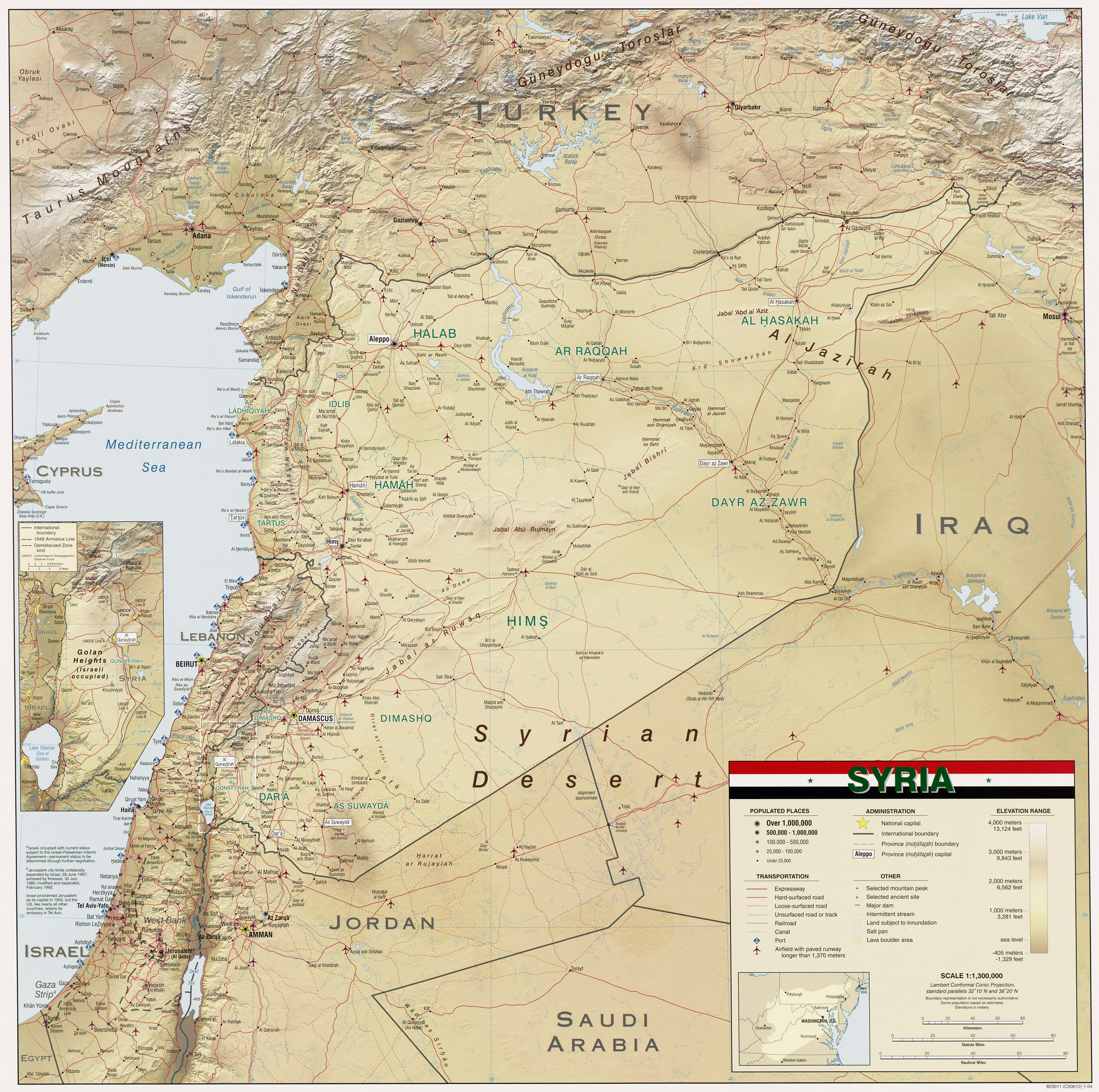
شهر حماه سوریه

Syrian Arab Republic
الجمهوریة العربیة السوریة
مدینه الحماه
Hama
حَمات یا حَما (به عربی: حماة) یکی از شهرهای کشور سوریه است. این شهر مرکز استان حمات است.
نام این شهر در متون قدیمی پارسی «حمات» نوشته شدهاست، اما در خود این شهر و همچنین در نشریات جدید از آن تحت نام «حما» یاد میشود.
- «حماة شهری است مشهور در میان شهرهای جهان و همسخن دیرینهٔ زمان، اما فراخنایی چندان و و بنایی درخشان ندارد. برچیده دامان و پیرامون آن بسته و خانههای بههم فشرده و پیوسته. دیدهور چون از فراز بر آن نگرد چشماندازی دلپذیر نیابد، گویی شهر به نمایش خود نشتابد و عیان کردن محاسن خود را برنتابد، اما چون دیده را به دقّت گماری و بر آثار و بناهای حماة به کاوش گام گذاری و در سایههای شهر از نزدیک به دیدهبانی نشینی، زیباییهای نهفتهٔ درونش را بینی. در بیرون شهر، بر سوی شرق رودی بزرگ هست که هرچه پیش رَوَد در گسترش است و بر دو کنارهاش، جابهجا دولابها به یکدیگر در نگرش و چرخهای آبکش در گردش، همچون دو طرّهٔ آراستهٔ تابیده که بر زمین کشیده و شاخسار بوستانها بر روی آن خمیده است و شادابی هر دو بخش آن طراوات رخسارهٔ دوشیزگان صاحب جمال را به یاد آرد و شتاب جریان آبش اندکاندک روی به اعتدال گذارد.»
- ابن جبیر، در ۲۰ ربیعالاول ۵۸۰/ ۳۰ ژوئن ۱۱۸۴
- «شالودهٔ شهر حمات را در گودالِ زمینی پهناور و کشیده نهاده و برآوردهاند چنانکه گویی خندقی است که دو دیوار بر دو جانب آن چیدهاند، یکی بهسانِ کوهی است کشیده که شهرِ بالا به بدنهٔ آن سمتِ کوهستنای پیوسته است و دژ در جانب دیگر بر پشتهای بزرگ و دایرهوار و جدا از شهر قرار دارد.»
- ابن جبیر، در ۲۰ ربیعالاول ۵۸۰/ ۳۰ ژوئن ۱۱۸۴


مدینة حماة هی إحدى المدن السوریّة القدیمة، وتقع على نهر العاصی، على ارتفاع مئتین وسبعین متراً عن سطح البحر، وتحتلّ المرتبة الرابعة من حیث عدد السکان بعد العاصمة دمشق، ثمّ حلب وحمص، ویبلغ عدد سکانها 854000 نسمة، وتمتاز بمناخها الجمیل والمعتدل کباقی المدن السوریة الجمیلة، فالهواء فیها ینعش النفوس، ومناظر الخضرة والورود تزهو بها الروح.
تاریخ مدینة حماة تعتبر مدینة حماة من المدن کنعانیة الأصل، وأطلق علیها اسم إیماتا، ومعناها الحصن، استولى الرومان على المدینة عام 64 م، وقاموا بإنشاء النواعیر فیها على ضفاف نهر العاصی تحدیداً، واهتموا بالزراعة تحدیداً زراعة الزیتون، فلا تکاد تخلو قریة من قرى حماة من معاصر زیت الزیتون. استطاع الصحابی أبو عبیدة عامر بن الجراح من فتح مدینة حماة، وقام بتولیة عبادة بن الصامت کوالی علیها، وکانت من أهم المدن الأمویة فی عصر الأمویین، وتوالت علیها الأحداث حیث قام الصلیبیین باحتلال المدینة 1129م، بعد أن قام نور الدین زنکی بفتحها، وتولیة ابنه عماد الدین زنکی علیها بعد وفاته عام1147م، وفی عام 1259 قام المغول باحتلال المدینة بقیادة هولاکو، حیث قام بهدم أسوارها، وحرق ما فیها من ذخائر، وباع ما کان فی دار السلطنة من کتب بثمن بخس جداً، واستمرّت حماة فی الدخول من حقبة احتلالیة إلى أخرى، حتى جاء السلطان العثمانی سلیم الأول، حیث ازدهرت فی عصره المدینة، واشتهر فیها العدید من العلماء والأدباء والکتاب، وتطوّرت الصناعة والتجارة.
السیاحة فی مدینة حماة تعتبر المدن السوریة من أهم المدن السیاحیة العربیة، ومن ضمنها مدینة حماة، حیث یوجد فیها العدید من الجبال والمصایف والشواطىء، ومن أهم الأماکن السیاحیة فیها: نواعیر حماة: تعد من أضخم السواقی فی العالم، فهی تقف على نهر العاصی، وتعدّ من أکثر المناظر روعة فی المدینة، وقاموا بإطلاق اسم مدینة النواعیر على مدینة حماة تیمناً بها. قلعة حماة وقصر العظم: یعتبر من متاحف الفنون الشعبیة فی المدینة، ویقع فی وسط مدینة حماة، وکان القصر ملکاً لأحد وجهاء المدینة، ویحتوی على العدید من التحف والآثار النادرة.
جوامع وکنائس مدینة حماة الجوامع: جامع الرحمة فی حی القصور. جامع الأعلى الکبیر. جامع صلاح الدین. جامع المحسنین. جامع أبی الفداء. الکنائس: کنیسة الروم الأرثوذکس. کنیسة مار الیاس. کنیسة رقاد السیدة العذراء. یقام فی مدینة حماة مهرجان سنوی، یسمّى مهرجان الربیع، حیث تقام فیه حفلات فلکلوریة وشعبیة، من جمیع المحافظات السوریة.
إقرأ المزید على موضوع.کوم: https://mawdoo3.com/%D9%85%D8%AF%D9%8A%D9%86%D8%A9_%D8%AD%D9%85%D8%A7%D8%A9
Hama (Arabic: حماة Ḥamāh, [ħaˈmaː]; Syriac: ܚܡܬ Ḥmṭ, "fortress"; Biblical Hebrew: חֲמָת Ḥamāth) is a city on the banks of the Orontes River in west-central Syria. It is located 213 km (132 mi) north of Damascus and 46 kilometres (29 mi) north of Homs. It is the provincial capital of the Hama Governorate. With a population of 854,000 (2009 census), Hama is the fourth-largest city in Syria after Damascus, Aleppo and Homs.
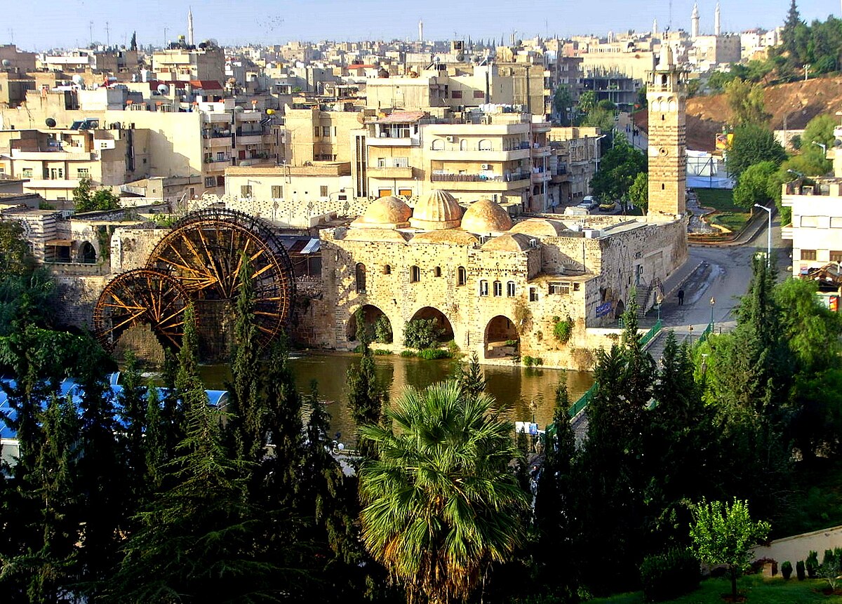
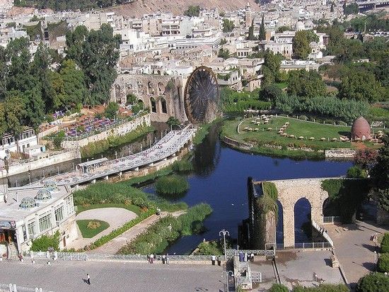
The city is renowned for its seventeen norias used for watering the gardens, which are locally claimed to date back to 1100 BC. Though historically used for purpose of irrigation, the norias exist today as an almost entirely aesthetic traditional show.
History[edit]
Ancient era[edit]

The ancient settlement of Hamath was occupied from the early Neolithic to the Iron Age. Remains from the Chalcolithic have been uncovered by Danish archaeologists on the mount on which the former citadel once stood.[4]The excavation took place between 1931 and 1938 under the direction of Harald Ingholt. The stratigraphy is very generalized, which makes detailed comparison to other sites difficult. Level M (6 m or 20 ft thick) contained both white ware (lime-plaster) and true pottery. It may be contemporary with Ras Shamra V (6000–5000 BC). The overlying level L dates to the Chalcolithic Halaf culture.
Amorite period and the Mittanni[edit]
Although the town appears to be unmentioned in cuneiform sources before the first millennium BC,[5] the site appears to have been prosperous around 1500 BC, when it was presumably an Amorite dependency of Mitanni, an empire along the Euphrates in northeastern Syria.[4] Mitanni was subsequently overthrown by the Hittites, who controlled all of northern Syria following the famous Battle of Kadesh against Ancient Egypt under Ramesses II near Homs in 1285 BC.
In early 19th century, Johann Ludwig Burckhardt was the first to discover Hittite or Luwian hieroglyphic script at Hama.[6]
The site also shows signs of Assyrian and Aramaean settlement.[4]
Neo-Hittites[edit]
By the turn of the millennium, the centralized old Hittite Empire had fallen, and Hama is attested as the capital of one of the prosperous Syro-Hittite statesknown from the Hebrew Bible as Hamath (Aramaic: Ḥmt; Hittite: Amatuwana;[5] Hebrew: חֲמָת Ḥəmåṯ), which traded extensively, particularly with Israel and Judah.[7]
Assyrian inscriptions[edit]
When the Assyrian king Shalmaneser III (858–824 BC) conquered the north of Aramea, he reached Hamath (Assyrian: Amat or Hamata)[5] in 835 BC; this marks the beginning of Assyrian inscriptions relating to the kingdom.[8] Irhuleni of Hamath and Hadadezer of Aram-Damascus (biblical "Bar-Hadad") led a coalition of Aramean cities against the encroaching Assyrian armies. According to Assyrian sources, they were confronted by 4,000 chariots, 2,000 horsemen, 62,000 foot-soldiers and 1,000 Arab camel-riders in the Battle of Qarqar. The Assyrian victory seems to have been more of a draw, although Shalmaneser III continued on to the shore and even took a ship to open sea. In the following years, Shalmaneser III failed to conquer Hamath or Aram-Damascus. After the death of Shalmaneser III, the former allies Hamath and Aram-Damascus fell out, and Aram-Damascus seems to have taken over some of Hamath's territory.
An Aramaic inscription of Zakkur, dual king of Hamath and Luhuti, tells of an attack by a coalition including Sam'al under Ben-Hadad III, son of Hazael, king of Aram-Damascus. Zakir was besieged in his fortress of Hazrak, but saved by intervention of the God Baalshamin. Later on, the state of Sam'al came to rule both Hamath and Aram.[citation needed]
In 743 BC, Tiglath-Pileser III took a number of towns in the territory of Hamath, distributed the territories among his generals, and forcibly removed 1,223 selected inhabitants to the valley of the Upper Tigris; he exacted tribute from Hamath's king, Eni-Ilu (Eniel).
In 738 BC, Hamath is listed among the cities again conquered by Assyrian troops. Over 30,000 natives were deported to Ullaba and replaced with captives from the Zagros Mountains.[5]
Destruction under Sargon II[edit]
After the fall of the northern kingdom of Israel, Hamath's king Ilu-Bi'di (Jau-Bi'di) led a failed revolt of the newly organized Assyrian provinces of Arpad, Simirra, Damascus, and Samara.
Styling himself the "Destroyer of Hamath," Sargon II razed the city c. 720 BC,[9] recolonized it with 6,300 Assyrians, and removed its king to be flayed alive in Assyria.[5] He also carried off to Nimrud the ivory-adorned furnishings of its kings.[10]
Hamath in the Bible[edit]
The few Biblical reports state that Hamath was the capital of a Canaanite kingdom (Genesis 10:18; 2 Kings 23:33; 25:21), whose king congratulated King David on his victory over Hadadezer, king of Zobah (2 Samuel 8:9-11; 1 Chronicles 18:9-11). In God’s instructions to Moses, Hamath is specified as part of the northern border of the land that will fall to the children of Israel as an inheritance when they enter the land of Canaan.[11] Solomon, it would seem, took possession of Hamath and its territory and built store cities.[12] 1 Kings 8:65 names the "entrance of Hamath", or Lebo-Hamath, as the northern border of Israel at the time of the dedication of the first temple in Jerusalem. The area was subsequently lost to the Syrians, but Jeroboam II, king of Israel, is said to have "restored the territory of Israel from the entrance of Hamath to the Sea of the Arabah (the Dead Sea)".[13]
Assyria's defeat of Hamath made a profound impression on Isaiah.[14] The prophet Amos also named the town "Hamath the Great".[15] Indeed, the name appears to stem from Phoenician khamat, "fort."[16]
Hellenistic and Roman history[edit]

In the second half of the 4th century BC the modern region of Syria came under the influence of Greco-Roman culture, following long lasting semitic and Persian cultures. Alexander the Great's campaign from 334 to 323 BC brought Syria under Hellenic rule. Since the country lay on the trade routes from Asia to Greece, Hama and many other Syrian cities again grew rich through trade. After the death of Alexander the Great his Near East conquests were divided between his generals, and Seleucus Nicator became ruler of Syria and the founder of the Seleucid dynasty. Under the Seleucids there was a revival in the fortunes of Hama. The Aramaeans were allowed to return to the city, which was renamed Epiphaneia[5] (in Greek: Επιφανεία), after the Seleucid Emperor Antiochus IV Epiphanes. Seleucid rule began to decline, however, in the next two centuries, and Arab dynasties began to gain control of cities in this part of Syria, including Hama.[17]
The Romans took over original settlements such as Hama and made them their own. They met little resistance when they invaded Syria under Pompey and annexed it in 64 BC, whereupon Hama became part of the Roman province of Syria, ruled from Rome by a proconsul. Hama was an important city during the Greek and Roman periods, but very little archaeological evidence remains.[17]
In AD 330, the capital of the Roman Empire was moved to Byzantium, and the city continued to prosper. In Byzantine days Hama was known as Emath or Emathoùs (Εμαθούς in Greek). Roman rule from Byzantium meant the Christian religion was strengthened throughout the Near East, and churches were built in Hama and other cities. The Byzantine historian John of Epiphania was born in Hama in the 6th century.[17]
Muslim rule[edit]

During the Muslim conquest of Syria in the 7th century, Hama was conquered by Abu Ubaidah ibn al-Jarrah in 638 or 639 and the town regained its ancient name, and has since retained it. Following its capture, it came under the administration of Jund Hims and remained so throughout the rule of Umayyads until the 9th century.[18]
Arab geographer al-Muqaddasi writes Hama became a part of Jund Qinnasrin during Abbasid rule.[19] Although the city's history is obscure at this time period, it is known that Hama was a walled market town with a ring of outlying cities. It came under the control of the Hamdanid rulers of Aleppo in the 10th century and was consequently drawn into the orbit of that city where it remained until the 12th century.[18] These were considered the "dark years" of Hama as the local rulers of northern and southern Syria struggled for dominance in the region. The Byzantines under emperor Nicephorus Phocas raided the town in 968 and burned the Great Mosque. By the 11th century, the Fatimids gained suzerainty over northern Syria and during this period, the Mirdasids sacked Hama.[18] Persian geographer Nasir Khusraw noted in 1047 that Hama was "well populated" and stood on the banks of the Orontes River.[20]
Tancred, Prince of Galilee, took it in 1108, but in 1114 the Crusaders lost it definitively to the Seljuks. The governor of Hama in the early 12th century was Ali Kurd, and his sons, Nasir and Kurdanshah became vassals of Toghtekin.[21] In 1157 an earthquake shattered the city.[22] For the next sixty years, Hama was battled for by competing rulers. Nur al-Din, the Zengid sultan, erected a mosque with a tall, square minaret in the city in 1172.[23] In 1175, Hama was taken from the Zengids by Saladin. He granted the city to his nephew, al-Muzaffar Umar, four years later, putting it under the rule of his Ayyubid family. This ushered in an era of stability and prosperity in Hama as the Ayyubids ruled it almost continuously until 1342.[18] Geographer Yaqut al-Hamawi, who was born in Hama, described it in 1225 as a large town surrounded by a strongly built wall.[24] Hama was sacked by the Mongols in 1260, as were most other Syrian cities, but the Mongols were defeated that same year and then again in 1303 by the Mamluks who succeeded the Ayyubids as rulers of the region.[17] Hama briefly passed to Mamluk control in 1299 after the death of governor al-Mansur Mahmoud II. However, unlike other former Ayyubid cities, the Mamluks reinstated Ayyubid rule in Hama by making Abu al-Fida, the historian and geographer, governor of the city and he reigned from 1310 to 1332.[18] He described his city as "very ancient... mentioned in the book of the Israelites. It is one of the pleasantest places in Syria."[25] After his death, he was succeeded by his son al-Afdal Muhammad who eventually lost Mamluk favor and was deposed. Thus, Hama came under direct Mamluk control.[18]
Hama grew prosperous during the Ayyubid period, as well as the Mamluk period. It gradually expanded to both banks of the Orontes River, with the suburb on the right bank being connected to the town proper by a newly built bridge. The town on the left bank was divided into upper and lower parts, each of which was surrounded by a wall. The city was filled with palaces, markets, mosques, madrasas, and a hospital, and over thirty different sized norias (water-wheels). In addition, there stood a massive citadel in Hama.[18] Moreover, a special aqueduct brought drinking water to Hama from the neighboring town of Salamiyah.[18]
Ibn Battuta visited Hama in 1335 and remarked that the Orontes River made the city "pleasant to live in, with its many gardens full of trees and fruits." He also speaks of a large suburb called al-Mansuriyyah (named after an Ayyubid emir) that contained "a fine market, a mosque, and bathes."[25] In 1400, Timurlane conquered Hama, along with nearby Homs and Baalbek.[26]
Ottoman rule[edit]

The prosperous period of Mamluk rule came to an end in 1516, when the Ottoman Turks conquered Syria from the Mamluks after defeating them at the Battle of Marj Dabiq near Aleppo. Hama, and the rest of Syria, came under Ottoman rule from Constantinople.[27] Under the Ottomans, Hama gradually became more important in the administrative structure of the region. It was first made capital of one of the liwas ("districts") of the vilayet ("province") of Tripoli.[18] Hama once again became an important center for trade routes running east from the Mediterranean coast into Asia. A number of khans ("caravansaries"s) were built in the city, like Khan Rustum Pasha which dates from 1556. Syria was later divided into three governorships and Hama was ruled by the governorship based at Aleppo.[27]
Then in the 18th century, it became a part of the holdings of the governor of Damascus.[18] The governors of Damascus at this time were the Azems, who also ruled other parts of Syria, for the Ottomans. They erected sumptuous residences in Hama, including the Azem Palace and Khan As'ad Pasha which were built by As'ad Pasha al-Azem, who governed Hama for a number of years until 1742.[27] By then, there were 14 caravansaries in the city, mostly used for the storage and distribution of seeds, cotton, wool, and other commodities.[28] After the passing of the Vilayet Law in 1864, Hama became the capital of the Sanjak of Hama (gaining the city more administrative powers), part of the larger vilayet of Sham.[18]
Modern history[edit]


Ottoman rule ended in 1918, after their defeat in World War I to the Allied Forces. Hama was made part of the French Mandate of Syria. By then, Hama had developed into what it has remained: a medium-sized provincial town, important as the market for an agricultural area abundant in cereals, but also cotton and sugar beets. It gained notoriety as the center of large estates worked by peasants and dominated by a few magnate families. The 1925 Hama uprising occurred in the city during the Great Syrian Revolt against the French.
During the French Mandate, the district of Hama contained within its bounds the municipality of Hama and 114 villages. By an estimate in 1930, only four of these villages were owned outright by local cultivators, while sharing ownership of two villages with a notable family. Thus, the hinterland was owned by landowning elites.[29] Starting in the late 1940s, significant class conflict erupted as agricultural workers sought reform in Hama.
Syria gained full independence from France in 1946. Akram al-Hawrani, a member of an impoverished notable family in Hama, began to agitate for land reform and better social conditions. He made Hama the base of his Arab Socialist Party, which later merged with another socialist party, the Ba'ath. This party's ascent to power in 1963 signaled the end of power for the landowning elite.
Political insurgency by Sunni Islamic groups, particularly the Muslim Brotherhood, occurred in the city, which was reputed as a stronghold of conservative Sunni Islam. As early as the spring of 1964, Hama became the epicenter of an uprising by conservative forces, encouraged by speeches from mosque preachers, denouncing the policies of the Ba'ath. The Syrian government sent tanks and troops into the quarters of Hama's old city to put down the insurrection.[29]
In the early 1980s, Hama had emerged as a major source of opposition to the Ba'ath government during the Sunni armed Islamist uprising, which had begun in 1976. The city was a focal point for bloody events in the 1981 massacre and the most notable 1982 Hama massacre.[30] The most serious insurrection of the Syrian Islamic uprising happened in Hama during February 1982, when Government forces, led by the president's brother, Rifaat al-Assad, quelled the revolt in Hama with very harsh means.[31] Tanks and artillery shelled the neighbourhoods held by the insurgents indiscriminately, and government forces are alleged to have executed thousands of prisoners and civilian residents after subduing the revolt, which became known as the Hama massacre. The story is suppressed and regarded as highly sensitive in Syria.[32] The Hama Massacre led to the military term "Hama Rules" meaning the complete large-scale destruction of a military objective or target. The city was the site of conflict between the Syrian military and opposition forces as one of the main arenas of the Syrian civil war during the 2011 siege of Hama.
Climate[edit]
Its climate is classified as semi-arid (BSk) in Köppen-Geiger system.[33] Hama's inland location ensures that it receives no softening coastal influences and breezes from the Mediterranean Sea. As a result, the city has a much hotter and drier climate than nearby Homs.
| hideClimate data for Hama (1961–1990, extremes 1956–2004) | |||||||||||||
|---|---|---|---|---|---|---|---|---|---|---|---|---|---|
| Month | Jan | Feb | Mar | Apr | May | Jun | Jul | Aug | Sep | Oct | Nov | Dec | Year |
| Record high °C (°F) | 20.0 (68.0) |
23.1 (73.6) |
28.0 (82.4) |
36.2 (97.2) |
41.0 (105.8) |
42.0 (107.6) |
45.2 (113.4) |
45.0 (113.0) |
42.2 (108.0) |
37.6 (99.7) |
31.0 (87.8) |
25.2 (77.4) |
45.2 (113.4) |
| Average high °C (°F) | 11.4 (52.5) |
13.8 (56.8) |
17.9 (64.2) |
23.1 (73.6) |
29.3 (84.7) |
33.8 (92.8) |
36.2 (97.2) |
36.2 (97.2) |
33.8 (92.8) |
27.6 (81.7) |
19.7 (67.5) |
13.1 (55.6) |
24.7 (76.5) |
| Daily mean °C (°F) | 6.6 (43.9) |
8.3 (46.9) |
11.6 (52.9) |
15.9 (60.6) |
21.1 (70.0) |
25.8 (78.4) |
28.2 (82.8) |
27.9 (82.2) |
25.3 (77.5) |
19.3 (66.7) |
12.7 (54.9) |
7.9 (46.2) |
17.5 (63.5) |
| Average low °C (°F) | 2.9 (37.2) |
3.3 (37.9) |
5.4 (41.7) |
8.8 (47.8) |
12.9 (55.2) |
17.4 (63.3) |
20.2 (68.4) |
20.1 (68.2) |
17.1 (62.8) |
12.4 (54.3) |
6.6 (43.9) |
3.7 (38.7) |
10.9 (51.6) |
| Record low °C (°F) | −8.3 (17.1) |
−7.3 (18.9) |
−3.0 (26.6) |
−0.5 (31.1) |
5.9 (42.6) |
10.6 (51.1) |
14.7 (58.5) |
14.0 (57.2) |
9.5 (49.1) |
2.2 (36.0) |
−3.7 (25.3) |
−5.5 (22.1) |
−8.3 (17.1) |
| Average precipitation mm (inches) | 72.5 (2.85) |
54.3 (2.14) |
49.3 (1.94) |
32.3 (1.27) |
10.3 (0.41) |
3.8 (0.15) |
0.4 (0.02) |
0.1 (0.00) |
1.8 (0.07) |
21.4 (0.84) |
40.0 (1.57) |
66.5 (2.62) |
352.7 (13.89) |
| Average precipitation days (≥ 1.0 mm) | 9.9 | 8.1 | 7.4 | 4.5 | 1.8 | 0.3 | 0.0 | 0.0 | 0.3 | 2.8 | 5.1 | 9.0 | 49.2 |
| Average relative humidity (%) | 81 | 75 | 69 | 61 | 49 | 40 | 39 | 42 | 43 | 51 | 69 | 83 | 58 |
| Mean monthly sunshine hours | 127.1 | 151.2 | 217.0 | 249.0 | 325.5 | 366.0 | 387.5 | 356.5 | 312.0 | 257.3 | 192.0 | 130.2 | 3,071.3 |
| Mean daily sunshine hours | 4.1 | 5.4 | 7.0 | 8.3 | 10.5 | 12.2 | 12.5 | 11.5 | 10.4 | 8.3 | 6.4 | 4.2 | 8.4 |
| Source #1: NOAA[34] | |||||||||||||
| Source #2: Deutscher Wetterdienst (extremes 1956–2004, and humidity 1973–1993)[35] | |||||||||||||
Demographics[edit]

According to Josiah C. Russel, during the 12th century, Hama had a population of 6,750.[36] James Reilly accounts the historical population as: 1812- 30,000 (Burckhardt) 1830- 20,000 (Robinson) 1839- 30–44,000 (Bowring) 1850- 30,000 (Porter) 1862- 10–12,000 (Guys) 1880- 27,656 (Parliamentary Papers) 1901- 60,000 (Parliamentary Papers) 1902-1907 80,000 (Trade Reports) 1906- 40,000 (al-Sabuni) 1909- 60,000 (Trade Reports)[37] In 1932, while Hama was under the French Mandate, there were approximately 50,000 residents. In the 1960 census, there were 110,000 inhabitants. The population continued to rise, reaching 180,000 in 1978 and 273,000 in 1994.[38] The infant mortality rate per 1,000 live births in the Hama Governorate was 99.4.[39] A 2005 estimate had Hama's population at around 325,000 inhabitants.[40]
Most of the residents are Sunni Muslims (including mostly Arabs, Kurds, and Turkmen), although some districts of the city are exclusively Christian.[40] Hama is reputed to be the most conservative Sunni Muslim city in Syria since French Mandate times. During that period there was an old saying reflecting this characteristic: "In Damascus, it takes only three men to make a political demonstration, while in Hama it takes only three men to get the town to pray."[29] The Christian population mostly adheres to the Greek Orthodox Church or the Syriac Orthodox Church.[41]
Ecclesiastical status[edit]
The Greek Orthodox Church has a prelacy in Hama under the Patriarch of Antioch.[41] Hama is still a Roman Catholic titular see (referred to as "Hamath" or Amath"), suffragan of Apamea. It is as "Epiphania" that it is best known in ecclesiastical documents. Lequien mentions nine Greek bishops of Epiphania.[42] The first of them, whom he calls Mauritius, is the Manikeios whose signature appears in the First Council of Nicaea.[43] Currently, it has two Catholic archbishops, a Greek Melkite and a Syrian, the former residing at Labroud, the latter at Homs, reuniting the titles of Homs (Emesus) and Hamah.[44]
Main sights[edit]


Hama's most famous attractions are the 17 Norias of Hama (Arabic: نواعیر حماة), dating back to the Byzantine times. Fed by the Orontes river, they are up to 20 metres (66 ft) in diameter. The largest norias are the al-Mamunye (1453) and the al-Muhammediye (14th century). Originally they were used to route water into aqueducts, which led into the town and the neighbouring agricultural areas.
Other sights include:
- the museum, housed in an 18th-century Ottoman governor residence (Azem Palace). Remains in the exhibition include a precious Roman mosaic from the nearby village of Maryamin (4th century AD)
- al-Nuri mosque, finished in 1163 by Nur ad-Din after the earthquake of 1157. Notable is the minaret.
- The small Mamluk al-Izzi mosque (15th century)
- The mosque and Mausoleum of Abu al-Fida, a celebrated Ayyubid historian who was also governor of the city.
- al-Hasanain mosque, also rebuilt by Nur ad-Din after the aforementioned earthquake.
- The Great Mosque. Destroyed in the 1982 bombardment, it has been rebuilt in its original forms. It has elements dating from the ancient and Christian structures existing in the same location. It has two minarets, and is preceded by a portico with an elevated treasury.
https://en.wikipedia.org/wiki/Hama

در سال ۱۹۸۲ در این شهر شورش بزرگی علیه حکومت حزب بعث سوریه در این شهر به راه افتاد که ارتش سوریه برای در هم شکستن عملیات وسیعی را به اجرا گذاشت که حدود ۲۰ تا ۴۰ هزار نفر در آن کشته شدند. کشتار حمات در کنار نبردسپتامبر سیاه در اردن به عنوان خونبارترین عملیاتهای دولتهای عربی علیه ملتهای خود شناخته میشوند. رهبری این عملیات را رفعت اسد برادر رهبر سوریه حافظ اسد بر عهده داشت و شورشیان عمدتاً از گروههای اسلامگرا به ویژهاخوانالمسلمین بودند


استان حَمات (به عربی: محافظة حماة) یکی از استانهای کشور سوریه است.

جغرافیا
مرکز این استان شهر حمات است.
حمات یکی از قدیمیترین مناطق خاورمیانه است که انسانهای ماقبل تاریخ در آن زندگی میکردهاند.
مساحت این استان در حدود ۸۸۸۰ کیلومتر مربع میباشد.
رود عاصی از وسط این شهر میگذرد.
جمعیت
جمعیت استان حمات طبق سرشماری عمومی اخیر ۱٬۴۵۰٬۰۰۰ نفر بودهاست.
مرکز این استان شهر حمات است که در کرانهٔ رود عاصی بطول ۱۷۱ کیلومتر واقع شدهاست، در طول مسیر این رود درختزارهای زیادی بهویژه از مرکبات دیده میشود.
شهرستانها
مرکبات، بر زیبائی و جمال این شهر افزودهاست.
شهرها
استان حماه شامل ۹ شهر است:
کوی
آثار
قلعهٔ حمات یکی از مشهورترین قلعههای تاریخی سوریهاست. این دژ که در بالای تپهای راهبردی قرار دارد در جنگهای صلیبی نقش مؤثری داشتهاست.
منابع
- دکتر: شامی، یحیی، (موسوعة المدن العربیة والاسلامیة) ، دارالفکر العربی، بیروت، چاپ سال ۱۹۹۳ میلادی به (عربی).
- د. الیاس، جبرائیل، الجبور، :(المحافظات السوریة)، اصدار الهیئة العامة للبدیات والمدن، عام ۲۰۰۷ للمیلاد.
- لبیب، عبدالساتر، (قِصَة الحَضَاراة) ، دارالمشرق، بیروت، چاپ سال ۱۹۹۰ میلادی
- https://fa.wikipedia.org/wiki/%D8%A7%D8%B3%D8%AA%D8%A7%D9%86_%D8%AD%D9%85%D8%A7%D9%87
- https://fa.wikipedia.org/wiki/%D8%AD%D9%85%D8%A7%D8%AA


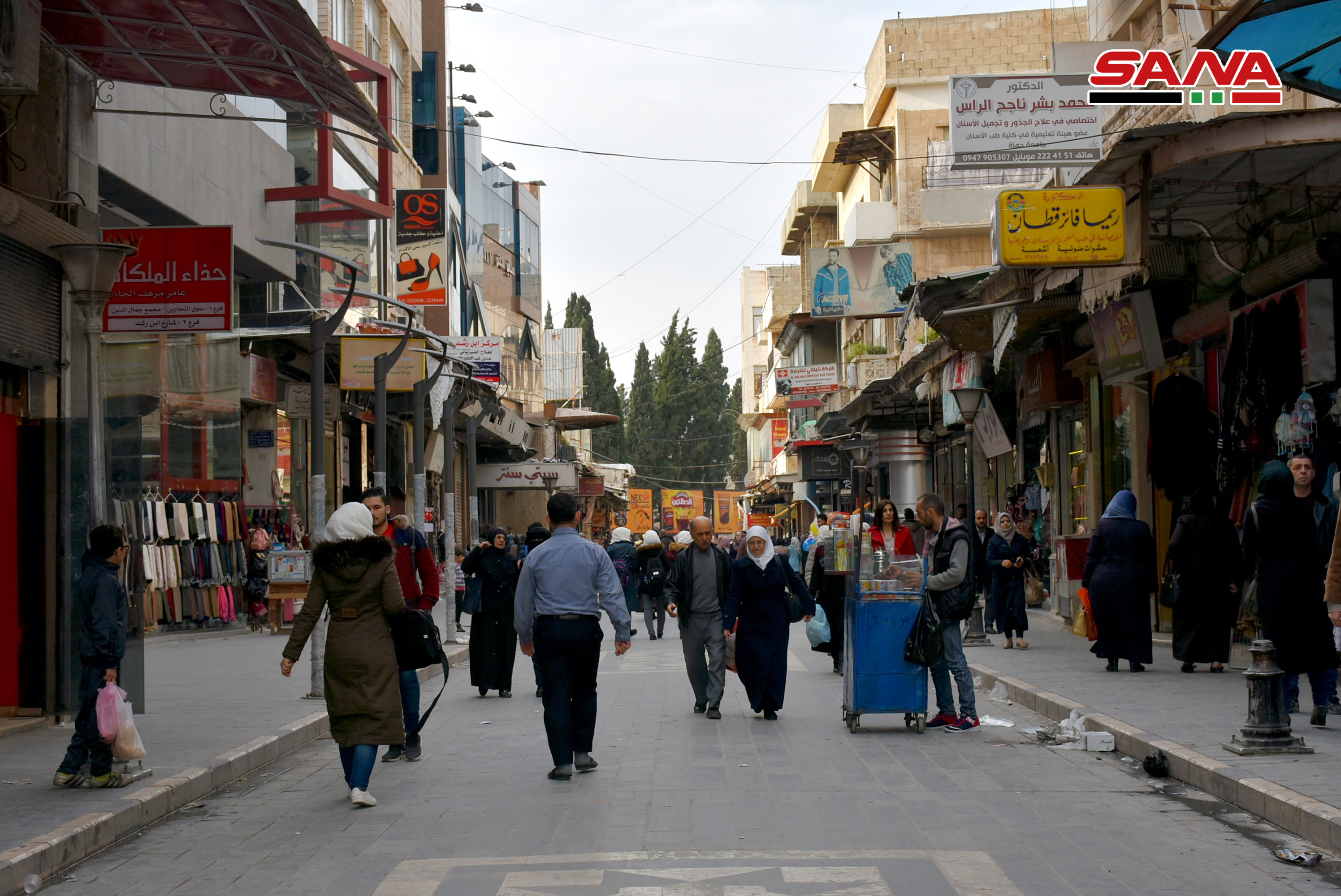
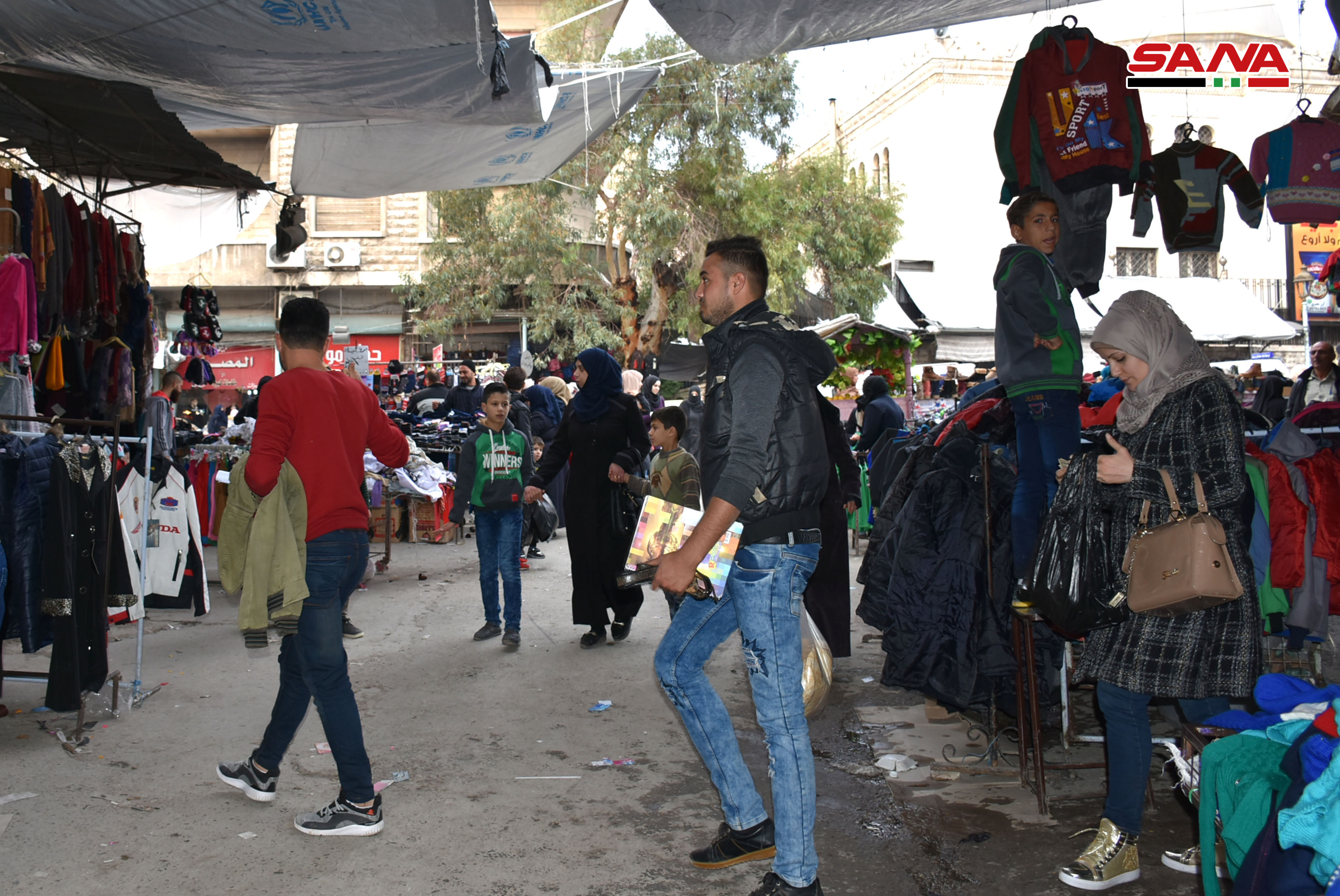
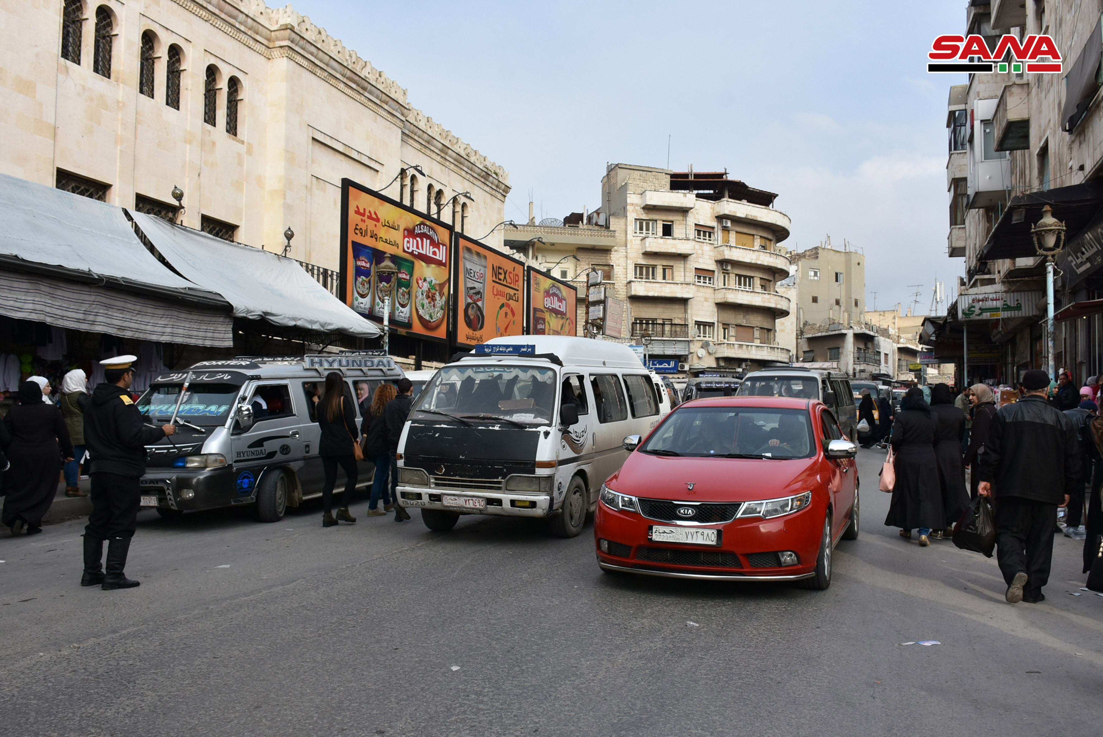
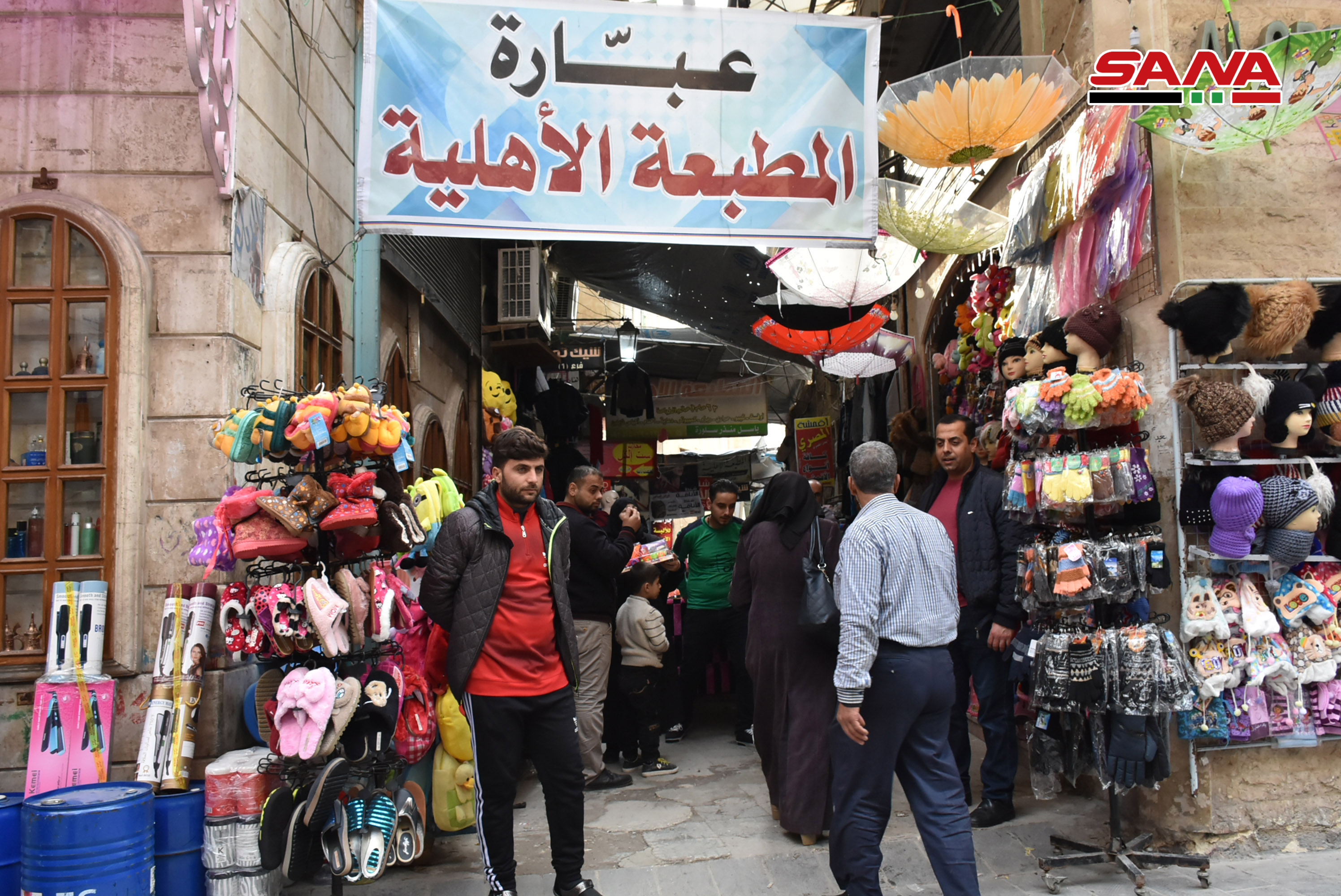
شهر حماه دیروز به روایت تصویر
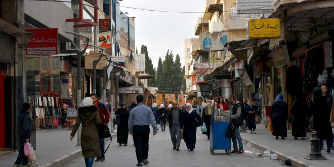
شهر حماه دیروز به روایت تصویر

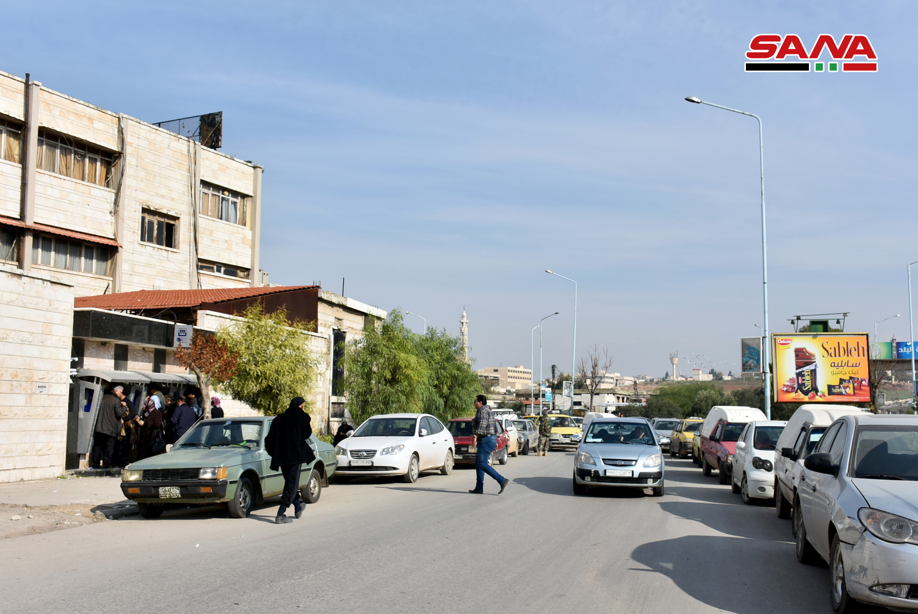
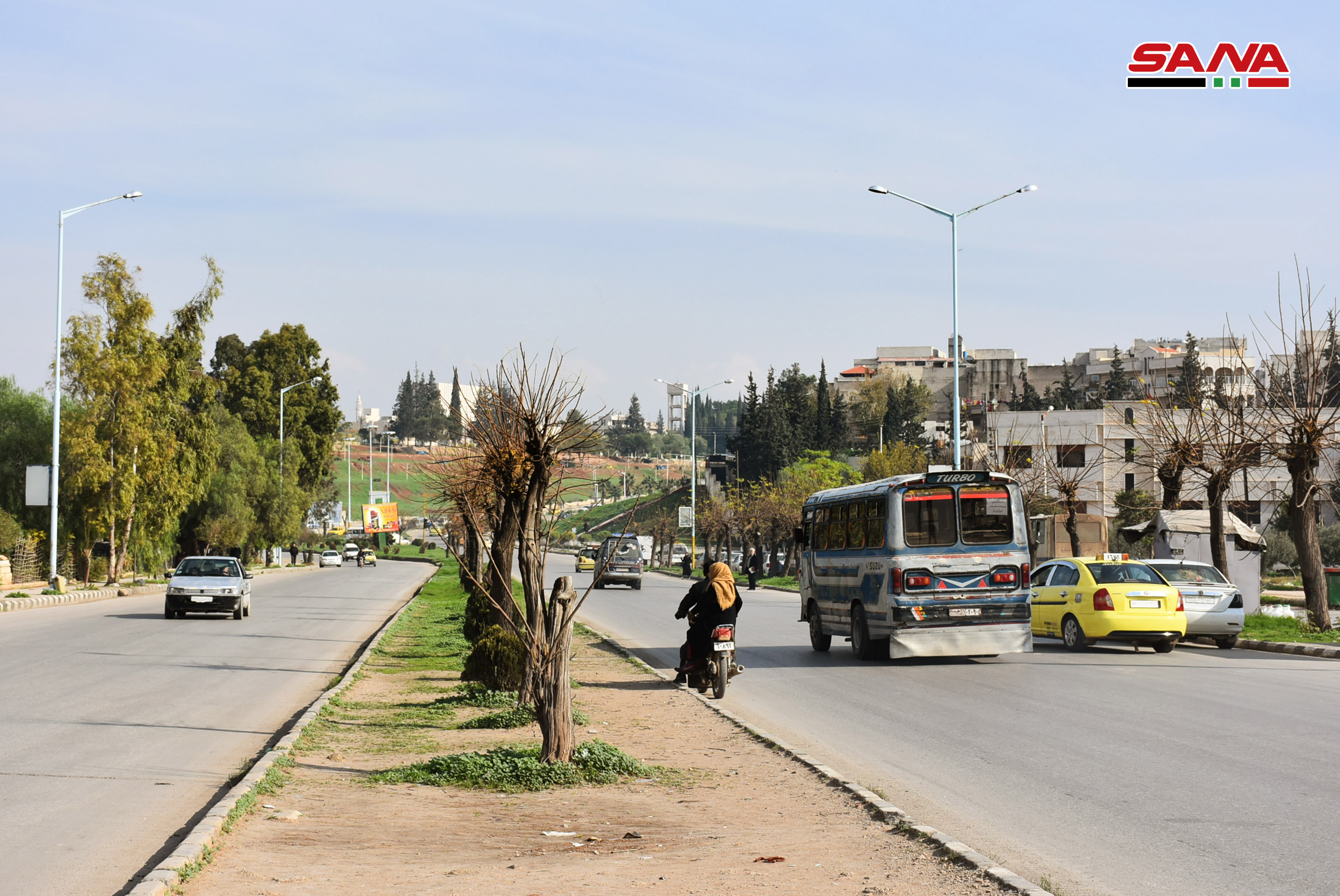


حماه إحدى أمهات الشام الرفیعة ومدائنها البدیعة

حماه إحدى أمهات الشام الرفیعة ومدائنها البدیعة

حما یا دار السلام ..
أغنیة شعبیة کنا نغنیها ونحن صغار ، کان لها وقع خاص فی أنفسنا ، علمتنا إیاها مدیرة المدرسة الابتدائیة للبنات فی تلدرة الأستاذة " رجاء حداد " مثل الحلم أذکرها کانت تسکن بالقرب من بیت جدی وکان لها علاقة جیدة مع کل الجیران ، أذکر وجهها ولا أعرف أن احدد ملامحها، لکن أظن أن عیناها ملونتان وکانت تضع ( شال ) فقط وکان یظهر منه مقدمة رأسها .
کانت من حماه وکانت تفتخر بمدینتها وتراثها ، لا أعرف نفسی إلا وأغنی هذه الأغنیة :
حما یا دار السلام فیک مربى الأســـــــــــــــودة
نحن عنا ما فی عیب البنت بتحمل بارودة .
سبب التسمیة :
حماه – تعنی ( قلعة أو حصن ) وفی اللغات الشرقیة یسمى الحصن " حامات " وقد سمیت حماة بهذا الاسم نسبة إلى قلعتها ، وقد طرأ تغییر على اسم المدینة حیث أطلق علیها فی زمن السلوقیین سنة / 301 / ق. م اسم " ابیفانیا " نسبة إلى الإمبراطور ( أنطیوخس أبیفانیوس ) ، ویطلق علیها مدینة النواعیر نظراً لإنفرادها عن بقیة مدن العالم بوجود النواعیر بهذا الحجم والعدد على ضفاف العاصی .
ودعیت بمدینة ( أبی الفداء ) نسبة إلى ملکها الأیوبی العالم والمؤرخ والجغرافی الکبیر " عماد الدین إسماعیل بن علی " الملقب بـ ( أبی الفداء ) .
فی وصف ابن بطوطة لحماه قال: " ثم سافرت إلى مدینة حماه إحدى أمهات الشام الرفیعة ومدائنها البدیعة ، ذات الحسن الرائق والجمال الفائق ، تحفها البساتین والجنات ، علیها النواعیر کالأفلاک الدائرات ، یشقها النهر العظیم المسمى العاصی " .
لمحة عن محافظة حماه :
حماه .. مزیج رائع من السهول والجبال والبوادی تربض على ضفاف نهر العاصی فی وسط سوریا على وادی الحیاة التاریخی الممتد من الأناضول إلى فلسطین .
تزخر محافظة حماه بالأماکن السیاحیة ، والطبیعة الفاتنة والغابات الوارفة والینابیع المتدفقة والمنازل والمتاحف الممیزة بطبیعة بنائها الخاصة، یتنفس عبقها التاریخی کل من عاش فیها ویعیش حیویة الحاضر وطموح المستقبل ، تبلغ مساحتها حوالی / 11000 / کم2 ، وعدد سکانها ما یقارب / 1950000 / نسمة .
تتمیز بعاصیها ذو الماء العذب الرقراق ، و الذی یبلغ طول مجراه الأخضر / 171 / کم ، ونواعیرها التی ماتزال بصوتها الجمیل تذکر إنسان الیوم بمنجزات إنسان الأمس ، وهی من أغنى محافظات القطر العربی السوری بالآثار التی تعود إلى عصور ما قبل التاریخ وتمتد على العصور المتلاحقة حتى أیامنا المعاصرة .
وتظهر لمسات الحضارة الحدیثة فی ساحاتها العامة الفسیحة والشوارع العریضة والأحیاء الحدیثة والفنادق الدولیة والمطاعم الراقیة والمعامل والمؤسسات والشرکات الإنتاجیة والمعامل الحدیثة.
وتتمیز المناطق العالیة فی المحافظة بهوائها اللطیف فی الصیف و بغاباتها التی ترتفع أکثر من / 1000 / م عن سطح البحر فی الغرب ، و الهضاب التی ترتفع / 400 / م ، و البوادی ومراعیها فی الشرق، وترى جمال الطبیعة بتنوع محاصیلها المزروعة ، وتسکن إلى البادیة برحابتها وبسمائها الصافیة وأرضها المغطاة بالربیع ، بتشکیلة من ألوان نباتاتها الرعویة المتعددة .
حماه التاریخیة:
یرجع تاریخ مدینة حماه إلى عصور موغلة فی القدم ، وهی من أهم المدن السوریة ومن أقدم مدن العالم التی مازالت تنبض بالحیاة. فی قلعة حماه / 13 / طبقة یرجع أقدمها إلى عصر النیولیتی ، ویرقى أحدثها إلى القرن الرابع عشر المیلادی ، وأثبتت الحفریات أن نواة المدینة تشکل فی الألف السادس قبل المیلاد.
تتمیز مدینة حماه بوجود أحیاء تعود لفترات قدیمة بالإضافة لوجود بعض الأوابد الأثریة والأبنیة القدیمة التی تتناثر ضمن أحیاء تجدد بناؤها عبر الزمن .
النواعیر :
تطل على ضفاف نهر العاصی الذی یعتبر الشریان الحیوی للمدینة مساحات واسعة من البساتین والمناطق الخضراء والتی تضفی على المدینة ألقاً وجمالاً ، وتنتشر على ضفافه نواعیر حماه التی تعتبر من أبرز المعالم التاریخیة والأثریة التی تمیزت بها المدینة .
والناعورة ، آلة مائیة ذات حرکة دائمة معدة لرفع الماء یعود تاریخ بنائها إلى الآرامیین وهی مؤلفة من أخشاب ومسامیر حدیدیة تغطس بالماء وصنادیقها منقلبة فارغة وترتفع ملآنة وتصب الماء فی قناة ذات قناطر متعددة وتسقی به البساتین وأکثر الحمامات وبعض الدور والجوامع والخانات والمقاهی.
یذکر أن مدینة حماه کانت تحوی على / 116 / ناعورة فی بدایة القرن السادس عشر اندثر معظمها وبقی منها 19 ناعورة فقط ضمن مدینة حماه وناعورتان فی شیزر .
الخانات والأحیاء :
ویوجد داخل حماه / 30 / خاناً أهمها:
خان أسعد باشا العظم ویقع بالقرب من باب البلد ، وخان رستم باشا یقع فی شارع المرابط ، وهناک خانات کثیرة فی السوق الطویل مثل خان الحنة وخان الجمرک وخان الصحن , وفی الحاضر خان برهان وخان عجیل.
یوجد فی حماه العدید من الأحیاء القدیمة من أهمها: حی الطوافرة الذی مازال یحافظ على نسیجه العمرانی ویرتاده الکثیر من السیاح. ویوجد أحیاء أخرى مثل حی الباشورة وحی المدینة وحی العبیسی .
الکنائس :
فی حماه الکنائس ومن أهمها : کنیسة حماه القدیمة : بنیت فی العصر الآرامی کما دلت اکتشافات القاعدة الحجریة لتمثال أسد منحوت من الحجر البازلتی خلال أعمال الترمیم التی جرت لبناء الکنیسة . وکانت معبد للإله الآرامی " هدد" أو " حدد " الاسم الذی یعنی المفرد أو الواحد أو الکبیر ثم حولت الى کنیسة فی العهود الأولى للمسیحیة خلال القرن الثالث المیلادی ومازالت مستخدمة حتى الآن .
القصور :
وکان فی مدینة حماة عدد کبیر من القصور من أهمها :
قصر أسعد العظم : شرع ببنائه عام / 1740 م – 1153 هـ / أسعد باشا وتابع البناء ابن أخیه نصوح باشا وأتمه ابن الأخیر المدعو " مؤید العظم بین عامی / 1239- 1245 هـ / 1824 – 1830م / ویتألف من أربعة أقسام 0 الحرملک مخصص للنساء – السلاملک مخصص للاستقبال والضیوف – الحمام- الإسطبل) وقد حول القصر الى متحف عام 1956 م وهناک قصور کبیرة بنیت من قبل أثریاء حماه فی العهود القدیمة وکلها مازالت قائمة تقع معظمها فی حی الطوافرة وحی العبیسی.
الحمامات :
و کان فی حماه / 16 / حماماً فی الربع الأول من هذا القرن وما زال قائما منها :
حمام الدرویشیة : فی محلة المرابط بناها بنو الأعوج.
حمام الأسعدیة : فی سوق المنصوریة ( السوق الطویل ) وقد بناه أسعد باشا العظم .
حمام العثمانیة : فی حی الطوافرة وهی منسوبة الى عثمان باشا.
حمام السلطان : شمال جامع النوری بناه الملک المنصور محمد بن الملک المظفر تقی الدین عمر وکان حمامه الخاص به وحالیاً سیتم ترمیم هذا الحمام وضعه فی الاستثمار .
حمام المؤیدیة: فی حی الطوافرة وهو الحمام الخاص بقصر العظم وینسب إلى مؤید باشا العظم.
حمام الحلق: فی حی الدباغة.
حمام العبیسی فی البارودیة بناه المؤید عماد الدین أبی الفداء.
أبواب حماه القدیمة .
الباب الغربی : وسمی بهذا الاسم لوقوعه فی القسم الغربی من السور وباب المغارة یقع فی الجراجمة وباب النهر وسمی بهذا الاسم للخروج منه إلى نهر العاصی وباب القبلی فی جنوبی سور المدینة وباب العمیان وسمی بهذا الاسم لکثرة خروج العمیان منه إلى سوق المنصوریة وباب العدة ومکانه جنوبی قلعة حماه وباب الجسر ویقع فی الجهة الشمالیة الغربیة وله باب آخر فی مبدئه من الجهة القبلیة . وباب حمص ویقع شرقی محلة الباشورة وباب النصر مجهول موقعه إلا أن أبا الفداء ذکره فی تاریخه لحوادث سنة 626هجریة ، وباب النقفی یقع شرقی باب الطیارة الحمراء عند قبو الحیرین وباب البلد ویقع جنوب سوق الطویل فی الطریق المؤدیة إلى ساحة الشهداء، وباب طرابلس ویقع فی الجهة الجنوبیة الغربیة من المدینة. وهناک أبوابا أخرى یذکرها العامة ولم نجد لها اثراً فی کتب التاریخ ( باب العرس وهو کما یقولون أحد أبواب سوق المنصوریة / الطویل / وباب الناعورة قرب جامع النوری.
